You Might Like
-

Colored Regional Map of Africa -

Blue Globe Network Icon -

Blue Globe Model for Geography Learning -

Green Globe Icon Representing Sustainability -

Complete Blue World Map -

Transportation Logistics with Global Shipment -

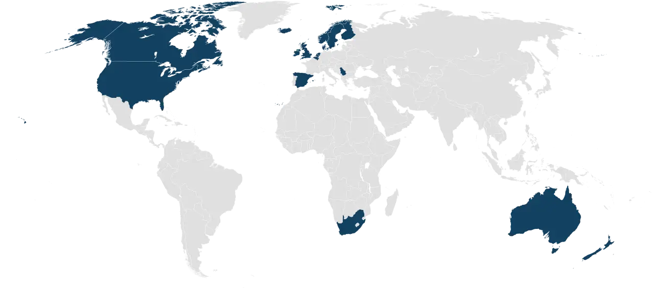
Map Highlighting Specific Regions -

Map of Turkey with Major Cities and Regions -

Blue Globe Icon for Global Connectivity -

Silhouette Globe Design with Continental Map -

Black Globe with Orbital Line Illustration -

Binary World Map -

Colorful World Map Globe Representation -

World Globe Icon -

Blue Map of Germany with Regions -

Light Bulb with Globe and Analytics -

Future Box Logo with Globe -
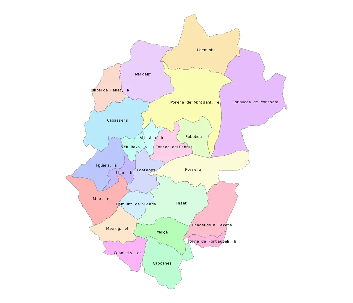
Color-Coded Map of Regional Divisions -

Network Globe Icon -
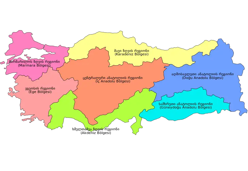
Colorful Regional Map of Turkey -

McKinsey Global Institute Logo -
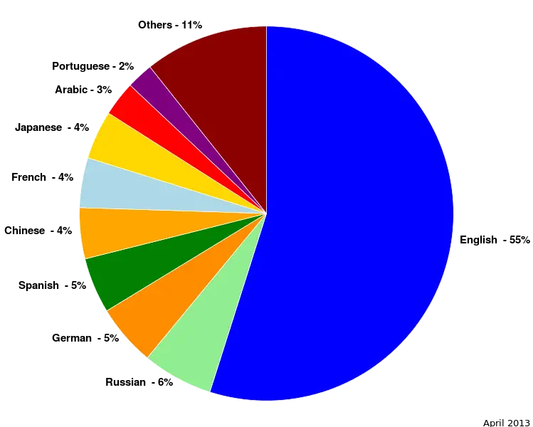
Colorful Statistical Pie Chart -

Green Robots with Earth -
World Map Outline for Education and Mapping -

Earth and Satellite in Space -

Computer Mouse and Globe for Internet Connection -

Digital Globe with Connected Lines -

Black and White Globe -

Airplane Icon with Globe for Travel Concepts -
Map with Highlighted Region in Red